As of late Monday, the National Hurricane Center has increased the
chance of development to a high chance (70%) of development in the next five days.
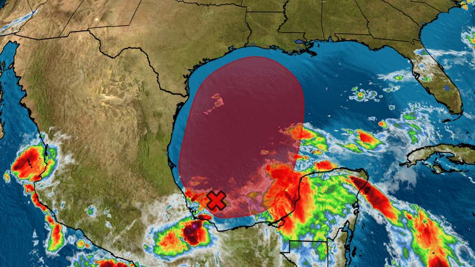
We continue to watch an area of showers and thunderstorms in the southwest Gulf of Mexico/Bay of Campeche. Currently, the system is still disorganized and likely won’t do much over the next two days. It will stay put in the southwestern Gulf through the middle of the week as an upper-level ridge keeps it nearly stationary. By the end of the week, it will likely drift north, and that’s when it will organize some as it heads toward the northern Gulf Coast.
Even if it stays messy, it looks like it will be a rainmaker somewhere along the Gulf Coast. Right now the biggest concern will be a heavy rain threat from roughly Friday to Sunday – but it’s too early to say exactly where this will happen or nail down other details.